Old Ordnance Survey Maps of Yorkshire - Sheet 232. 15. 1907
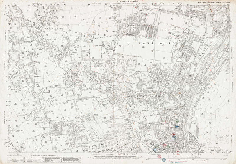
An old map of Batley (S), Dewsbury (N) in 1907 Scale 1:2500 or 25 inches to the mile : Original map size 40 x 29 inches [102 x 74 cms]
These unique maps originally belonged to Smith, Gotthardt & Co. of Bradford, Land Agents & Surveyors. The majority have fascinating hand-written additions referring to works and surveys carried out by the company approx. 1893 to 1920's. Despite their often poor condition, we have decided to offer them as downloadable PDF images of the original scans and as printed maps.
DESCRIPTION
MAP COVERAGE
Please refer to the modern map shown below.
Switching views from 'Sat' to 'Map' may be useful. TO CONFIRM A LOCATION ON THIS MAP, PLEASE EMAIL US YOUR QUERY BEFORE PURCHASE.
HAND-WRITTEN ADDITIONS
The coloured circles in the lower right corner mark pubs, off-licences, etc. Each one is named.
PURCHASE
INSTANT PDF DOWNLOAD 300dpi scan of the map seen below
complete with any additions as described above £5.99
LARGE PRINTED MAP Near full-size colour print of the map below.
33 x 24 inches on 120gsm coated paper.
Posted rolled in a tube.
£12.99
TO VIEW A SAMPLE MAP IN PDF FORMAT<< CLICK HERE >>you must use the Zoom function
< Return to Menu > Modern area from Google Maps (to re-set, refresh the page) [NOTE- approx. area only - please email if you need to confirm a location on the old map (above) before purchase]