OLD TOWNS BOOKS & MAPS
Old Maps of Buckinghamshire
Essentials for Local Historians, Genealogists & Family Historians
MODERN MAPS
LOOKING FOR A DETAILED ORDNANCE SURVEY MAP OF A BUCKINGHAMSHIRE TOWN? CLICK HERE
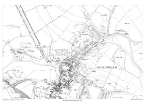
Size: 21.5 x 15.25 inches
Scale: 14 inches to the mile
CLICK MAP TO ENLARGEShowing the area from Overn Hill and Hangman's Tree in the north to the football ground in the south, and from the cemetery in the west to the Grand Union Canal in the east.
A large, brand new modern reprint
A FLAT-SHEET MAP (not folded)
SENT NEXT WORKING DAY
ROLLED IN A CARDBOARD TUBE
Full size 300dpi PDF format.
Instant secure download at purchase
View in Adobe Reader or similar software.
Zoom in for amazing detail.

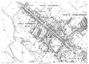
Stony Stratford in 1898
Size: 21.5 x 15.25 inches
Scale: 28 inches to the mile
CLICK MAP TO ENLARGEShowing the area from the gas works in the north to Calverton End in the southeast.
A large, brand new modern reprint
A FLAT-SHEET MAP (not folded)
SENT NEXT WORKING DAY
ROLLED IN A CARDBOARD TUBE
Full size 300dpi PDF format.
Instant secure download at purchase
View in Adobe Reader or similar software.
Zoom in for amazing detail.
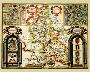
Buckinghamshire in 1610
by John Speed
Size: 16 x 20 inches
GO TO THE JOHN SPEED PAGE